


Transportation information for Tortola is provided below. Travel information includes driving directions, maps, airport information and more.
Airports
The main airport for flying into the British Virgin Islands is the Terrance B. Lettsome Airport which is located on Beef Island, linked to Tortola by the Queen Elizabeth II Bridge. When traveling to the British Virgin Islands, keep in mind that there are no direct flights from the US, Canada, Europe or South America. Flights to the British Virgin Islands originate from other islands in the Caribbean such as Antigua, St. Kitts, St. Thomas, Sand Juan or St. Maarten/St. Martin.
Chartered flights are available to get you to neighboring islands.
Map + Directions
Basic Directions
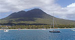
Tortola is the largest island in the British Virgin Islands and is located two miles over the water northeast of St John in the US Virgin Islands. The British Virgin Islands are located east of Puerto Rico within the Caribbean between the Caribbean Sea and the Atlantic Ocean.
Jeep rentals and car rentals are both available at a reasonable price for exploring the islands.

