Caribbean Map

Request Free Visitor Guides

1

Select a Free Visitor Guide below

2

Complete the form to receive your guides by mail

Below are the Free Visitor Guides for Caribbean Area.
Click here to view all the guides avialable for Caribbean.

Bonaire, Caribbean - Transportation

Maps, Directions, Airports, Rental Cars, Shuttles,...

Transportation information for Bonaire is provided below. Travel information includes driving directions, maps, airport information and more.

Airports

The primary airport for Bonaire is the Flamingo International Airport located near Kralendijk. Many large airlines such as American Airlines and Delta Air Lines provide service to the Flamingo International Airport. Another option for arriving to the islands is by cruise ship.

Chartered flights are available to get you to other islands within the Caribbean.

Map + Directions

Basic Directions

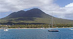
Bonaire is located approximately 50 miles off the coast of Venezuela and east of Curacao.

Car rentals are available at a reasonable price

Customizable Directions

:
:
:
Number in party:
:

Copyright © 1997 - 2024 The Go Travel Sites. All Rights Reserved and.

Email Page Link

Complete the form below to email this page to a friend or family member's email. You can send yourself an email as well. Your email and your recipient's email will NOT be shared with anyone. See our full Privacy Policy for details.
:
:
:


:
Copy Yourself on the Email Yes No
:
:

1

Select a Free Visitor Guide below

2

Complete the form to receive your guides by mail