


Transportation information for St. Vincent-Grenadines is provided below. Travel information includes driving directions, maps, airport information and more.
Basic Directions
St. Vincent and the Grenadines are located 24 miles south of St. Lucia, 75 miles north of Grenada, and 100 miles west of Barbados.
Car rentals are available but roads can be in bad condition. Driving at night is not suggested. Looking for something more adventurous? Consider renting a motorcycle or even a golf cart for getting around.
Airports
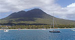
The primary airport is the E. T. Joshua Airport located in Kingstown, located in the southern area of St. Vincent. Direct flights are not available from North America or Europe. You must first arrive to a neighboring island such as Grenada, Barbados or even San Juan, Puerto Rico and then transfer to St. Vincent. Another option for arriving to the islands is by cruise ship or yacht.
Chartered flights are available to get you to the islands Bequia, Canouan, Mustique, and Union Island as well as other islands within the Caribbean.

